10 Savannah neighborhoods from the Historic District to New Hampstead: ZIP codes, zoned high schools and August 2026 Zillow home values, with a map.
Last checked Oct. 6, 2026. Sources: the City of Savannah’s neighborhood boundaries and neighborhood association list on SAGIS, the school system’s address lookup, the state’s 2025 School Grades data, Chatham County’s 2025 parcel digest, Zillow Research, the Census Bureau and OpenStreetMap.
Savannah is a city of 147,898 people in Chatham County, according to the Census Bureau’s 2020-2024 American Community Survey five-year estimates, spread over about 116 square miles. The old city sits on the bluff above the Savannah River, with its squares running south to Forsyth Park. Below that come the Victorian District, Thomas Square and the midtown neighborhoods south of Victory Drive, then the south side out to the rivers. I-16 ends downtown, I-516 curves around the west side, and I-95 runs north to south west of the city’s core.
Three things to know before you look at a listing:
- City limits are patchy. Some of the newest parts of Savannah, such as Godley Station near I-95 and New Hampstead near I-16, are miles from the rest of the city, with Pooler, Garden City and unincorporated land in between. Check the city on the parcel with the Chatham County Board of Assessors before you count on City of Savannah police, fire and trash service.
- ZIP codes cross city lines. Eleven ZIP codes have at least 10% of their land in the city, by the Census Bureau’s count. Zillow files 31407 under Port Wentworth, 31408 under Garden City and 31302 under Bloomingdale, so some Savannah homes have a Bloomingdale ZIP code.
- School zones do not follow city limits. The Savannah-Chatham County Public School System draws its zones countywide. We ran 150 Savannah homes chosen at random through the district’s address lookup on Oct. 6 and got eight different high schools: the School of Liberal Studies at Savannah High (27%), Beach (21%), Groves (18%), Windsor Forest (16%), Jenkins (10%), Johnson (6%), New Hampstead (2%) and Islands (1%). Always check one address.
The areas at a glance
High school shares are of the homes we checked in each area in the district’s lookup on Oct. 6. Home values are the Zillow Home Value Index for August 2026: a modeled typical value for the middle third of homes in the whole ZIP code, not a sale price. The citywide figure was $322,239.
| Area | Main ZIP code | Zoned high school | Typical value, main ZIP |
|---|---|---|---|
| Historic District | 31401 | Liberal Studies (82%), Groves (18%) | $556,330 |
| Victorian District | 31401 | Beach (60%), Liberal Studies (40%) | $556,330 |
| Thomas Square | 31401 | Liberal Studies (100%) | $556,330 |
| Ardsley Park and Chatham Crescent | 31405 | Beach (62%), Liberal Studies (38%) | $340,309 |
| Gordonston | 31404 | Liberal Studies (100%) | $251,419 |
| Carver Heights | 31415 | Groves (100%) | $143,468 |
| Windsor Forest | 31419 | Windsor Forest (100%) | $307,589 |
| Coffee Bluff and Rose Dhu | 31419 | Windsor Forest (100%) | $307,589 |
| Godley Station | 31407 | Groves (100%) | $309,208 |
| New Hampstead | 31419 and 31302 | New Hampstead (100%) | $307,589 (31419) |
“Liberal Studies” is the School of Liberal Studies at Savannah High.
Map of the areas
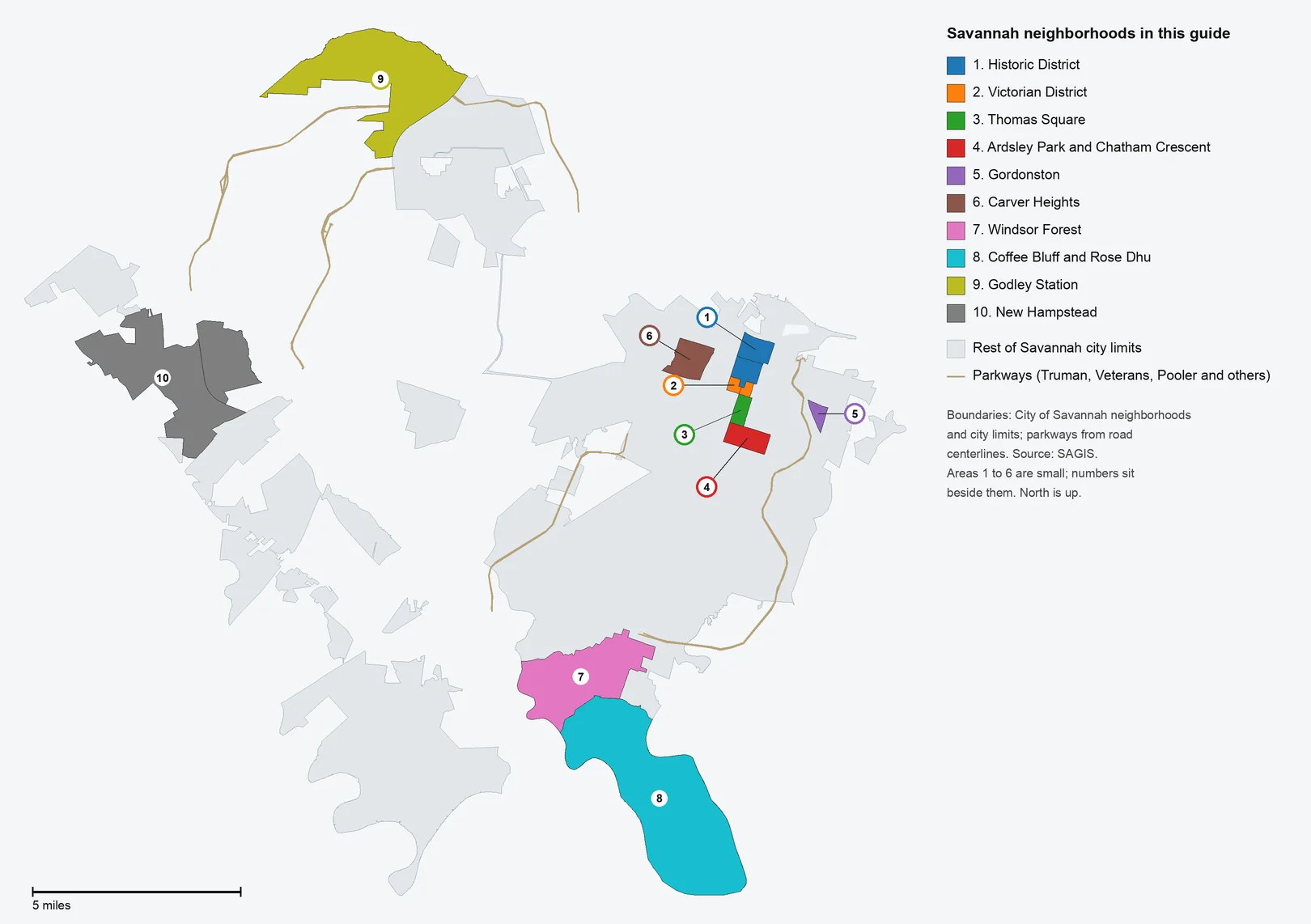
Map by Savannah News Today from the City of Savannah’s neighborhood boundaries and city limits on SAGIS, with parkways from SAGIS road centerlines.
The areas
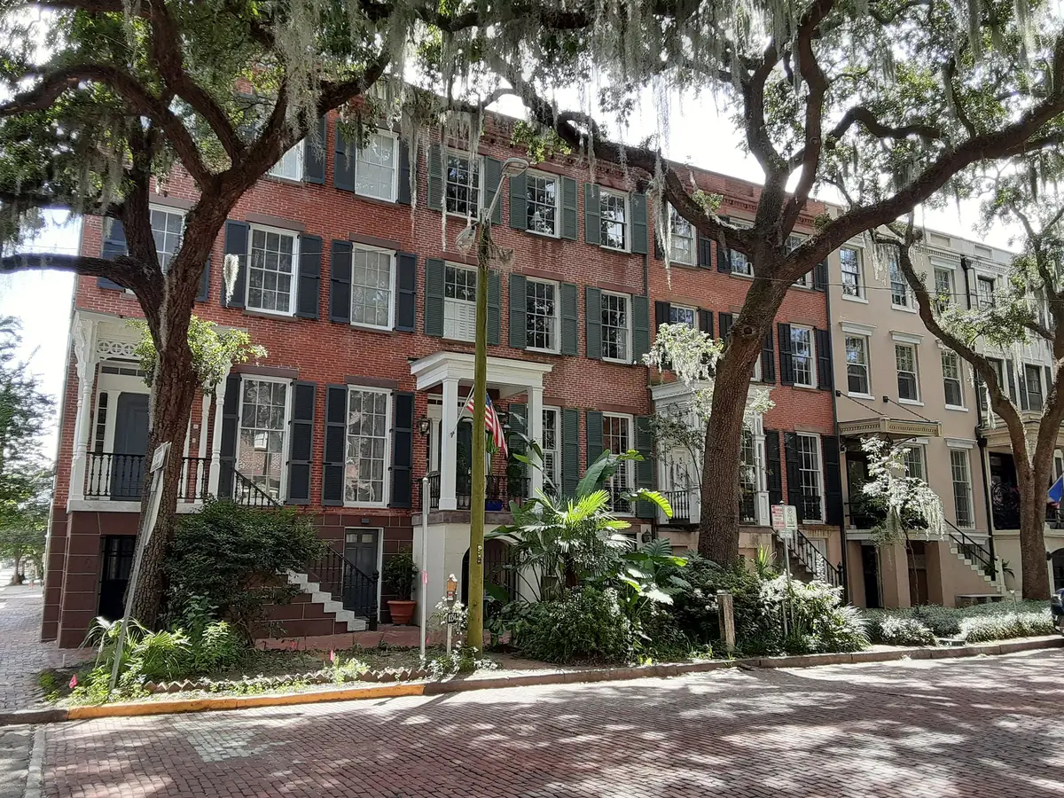
Historic District. The squares from the river to Forsyth Park, the city’s North and South Historic District neighborhoods. Townhouses and condominiums; 69% of residential parcels were built before 1940.
Victorian District. Gwinnett Street to Anderson Street on both sides of Forsyth Park. Houses built around 1900; the high school zone splits at Bull Street.
Thomas Square. Anderson Street to Victory Drive, east of Bull Street, around the park at 16 E. 35th St. Every home we checked was zoned for the same schools.
Ardsley Park and Chatham Crescent. Midtown homes from the 1920s to 1950, south of Victory Drive between Bull Street and Waters Avenue, with 10 small city parks.
Gordonston. A small east side neighborhood of 246 homes off Skidaway Road, with Pierpont Circle Park in the middle.
Carver Heights. West side homes from the 1930s to 1970, including the Carver Village Historic District, near I-16 exit 165.
Windsor Forest. A south side neighborhood of 2,126 homes, most built from 1958 to 1975, with its own elementary school, high school and ball fields.
Coffee Bluff and Rose Dhu. The south end on the Vernon, Little Ogeechee and Burnside rivers; 27% of homes date from 2000 or later.
Godley Station. West side subdivisions near I-95 and the airport, all built since 2000, zoned for Godley Station K-8.
New Hampstead. The far west side along Little Neck Road; half the homes were built in 2023 or later, and two schools are inside it.
Comparing Savannah with its neighbors
Taxes, schools, home values and commutes for Savannah, Garden City, Pooler and Richmond Hill side by side: Savannah vs Garden City vs Pooler vs Richmond Hill. For the citywide market, see our home prices guide; for calendars, enrollment and graduation rates, our schools guide; for tax bills, our property taxes guide.
How we built this
We named only areas a public source places on a map. The sources were:
- The city’s own neighborhood map. The City of Savannah’s Development Services Department keeps a layer of 106 named neighborhoods on SAGIS, the county and city mapping service. Every area in this guide follows those boundaries; three areas join neighborhoods the city splits in two (North and South Historic District, East and West Victorian District, New Hampstead and New Hampstead East).
- The city’s neighborhood association list, also on SAGIS, for the associations named on each page.
- OpenStreetMap place names, which independently name Ardsley Park-Chatham Crescent, Gordonston, Carver Village, Coffee Bluff and Windsor Forest.
- School zones from homes run through the school system’s own address lookup, and home counts and ages from the county’s 2025 parcel digest.
We chose 10 residential neighborhoods spread across the city, from the oldest to the newest. We left out neighborhoods on the city’s map that are mainly airport, port, industrial or military land, such as Hunter Army Airfield and the Savannah International Airport/Travis Field area. The city’s lookup and the county’s parcel records are the authority for any one address. Store and place data are © OpenStreetMap contributors.
Frequently asked questions
What are the neighborhoods in Savannah?
The City of Savannah’s own map divides the city into 106 neighborhoods. Our guide covers 10 of the main residential ones: the Historic District, the Victorian District, Thomas Square, Ardsley Park and Chatham Crescent, Gordonston, Carver Heights, Windsor Forest, Coffee Bluff and Rose Dhu, Godley Station and New Hampstead.
What ZIP codes are in Savannah?
Eleven ZIP codes have at least 10% of their land inside the city, by the Census Bureau’s count: 31401, 31404, 31405, 31406, 31407, 31408, 31409, 31415, 31419, 31421 and 31302. Several are shared with neighbors; Zillow files 31407 under Port Wentworth, 31408 under Garden City and 31302 under Bloomingdale.
Do Savannah school zones follow city limits?
No. The Savannah-Chatham County Public School System runs schools countywide. In our sample of 150 Savannah homes, eight different high schools came back, and Groves High, which serves Carver Heights and Godley Station, also serves most of Garden City.
How big is Savannah?
About 116 square miles inside city limits on the SAGIS municipal map, with 147,898 people in the Census Bureau’s 2020-2024 American Community Survey estimates.
Have your say