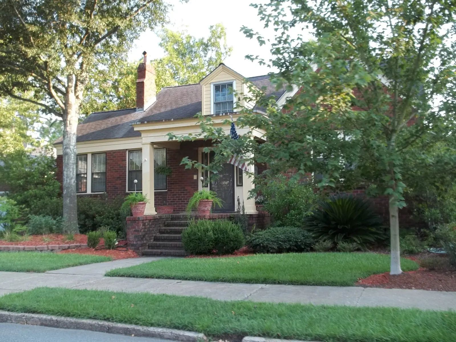
Ardsley Park and Chatham Crescent, south of Victory Drive, are ZIP 31405 with 10 small city parks. Zillow's typical value was $340,309 in August 2026.
Last checked Oct. 6, 2026. Sources: the City of Savannah’s neighborhood boundaries and neighborhood association list on SAGIS, the school system’s address lookup, the state’s 2025 School Grades data, Chatham County’s 2025 parcel digest, the SAGIS parks layer, Zillow Research, Chatham Area Transit and OpenStreetMap.
Ardsley Park and Chatham Crescent is a midtown neighborhood of single homes south of Victory Drive. The city’s map treats it as one neighborhood of about half a square mile, and OpenStreetMap names it the Ardsley Park-Chatham Crescent Historic District. Of its 1,087 parcels in the county’s records, 1,042 are residential, so very little of it is commercial.
What this means for you
- Zoned high school: Beach High on the west side, the School of Liberal Studies at Savannah High on the east side. Check one address in the district’s lookup.
- Home value: $340,309 in ZIP 31405 in August 2026, according to the Zillow Home Value Index.
- Nearest interstate exit: I-16 exit 167A, Martin Luther King Jr. Boulevard, or exit 165, 37th Street, each about 2 miles away in a straight line.
Part of our Savannah neighborhoods guide.
Where it is
The neighborhood starts at Victory Drive and runs south through East 44th Street to East 52nd Street, between Bull Street on the west and Waters Avenue on the east. Abercorn Street runs through it north to south and Washington Avenue east to west. The streets with the most addresses in the county’s 2025 parcel records are East 44th to East 52nd streets and Washington Avenue; Atlantic Avenue, Chatham Crescent and Lattimore Place are smaller streets inside it.
- ZIP code: 31405 for every home.
- Inside city limits: yes; the city provides police, fire and trash service.
- Neighborhood association: the city’s list names the Ardsley Park Chatham-Crescent Neighborhood Association.
Homes
- Half of the 1,042 residential parcels list a year built of 1930 or earlier.
- 75% were built before 1940, and nine in 10 by 1950.
- About 1% date from 2000 or later.
Schools
We ran 80 homes chosen at random from the county’s parcel records through the school system’s address lookup on Oct. 6. Scores are 2025 College and Career Ready Performance Index (CCRPI) figures from the state’s School Grades report.
| Level | School | Share of homes | 2025 CCRPI |
|---|---|---|---|
| High | Beach High, 3001 Hopkins St. (report card) | 62% | 67.8 |
| High | School of Liberal Studies at Savannah High, 400 Pennsylvania Ave. (report card) | 38% | 53.9 |
| Middle | Myers Middle, 2025 E. 52nd St. (report card) | 100% | 52.2 |
| Elementary | J.G. Smith Elementary, 210 Lamara Drive (report card) | 99% | 80.0 |
The high school line runs north to south through the neighborhood: the homes zoned for Beach were on the western blocks, nearer Bull and Abercorn streets, and those zoned for the School of Liberal Studies on the eastern blocks. One sampled address returned no elementary school. More in our schools guide.
Home values
The typical home value in ZIP 31405 was $340,309 in August 2026, down 2.24% from $348,100 in August 2025, according to the Zillow Home Value Index. The index is a modeled typical value for the middle third of homes, not a sale price. ZIP 31405 is much larger than the neighborhood, so the figure covers other parts of midtown and the west side too. The citywide Savannah figure was $322,239. More in our home prices guide.
Parks
The SAGIS parks layer lists 10 small city parks inside the neighborhood, most under an acre. Among them:
- Tiedeman Park, 502 Washington Ave., about 2.9 acres, the largest
- Theus Park, 624 E. 45th St.
- Solomon Park, 3290 Harmon St.
- Lattimore Park, 1 Lattimore Place
- Entleman Park on East 46th Street and Smith Gaudry Park on East 52nd Street
Daffin Park is east of Waters Avenue. More in our parks and trails guide.
Getting around
- Interstate: I-16 exit 167A, signed for Martin Luther King Jr. Boulevard in OpenStreetMap, and exit 165, for 37th Street, are each about 2 miles from the middle of the neighborhood in a straight line.
- City Hall: about 2.9 miles by road to 2 E. Bay St.
- Airport: about 13 miles by road to the Savannah/Hilton Head International Airport terminal. Both are distances on the OpenStreetMap road network, measured with the OSRM routing engine, not drive times.
- CAT buses: routes 4, 11, 14, 27 and 28 stop in or next to the neighborhood, according to Chatham Area Transit’s stop data. Times are on CAT’s schedules page.
Groceries and everyday stores
OpenStreetMap shows no supermarket or pharmacy inside the neighborhood. Within about a mile of its edge:
- Walgreens, 4600 Habersham St.
- Whole Foods Market, 1821 E. Victory Drive
How we drew this area
The edges are the City of Savannah’s boundary for its Ardsley Park/Chatham Crescent neighborhood, from the layer its Development Services Department keeps on SAGIS. School shares come from 80 randomly chosen homes run through the district’s lookup on Oct. 6, 2026; the lookup and the school system decide any one address. Home counts and years built are from the county’s 2025 parcel digest. Store locations are © OpenStreetMap contributors.
Frequently asked questions
Is Ardsley Park a good place to live in Savannah?
Here are the facts. Ardsley Park and Chatham Crescent is a city neighborhood south of Victory Drive in ZIP 31405, almost all single homes, with 10 small city parks. Homes are zoned for J.G. Smith Elementary (2025 CCRPI 80.0), Myers Middle (52.2) and Beach High (67.8) or the School of Liberal Studies (53.9), and Zillow put the typical value in 31405 at $340,309 in August 2026.
What high school is Ardsley Park zoned for?
It is split. In the district’s address lookup on Oct. 6, 2026, 62% of the homes we checked, on the west side nearer Bull and Abercorn streets, were zoned for Beach High and 38%, on the east side, for the School of Liberal Studies at Savannah High.
What ZIP code is Ardsley Park in Savannah?
- Every residential parcel in the city’s Ardsley Park/Chatham Crescent neighborhood has a 31405 address in Chatham County’s 2025 parcel records.
When were the houses in Ardsley Park built?
Mostly between the 1920s and 1950. In the county’s 2025 parcel records, half the homes list a year built of 1930 or earlier, 75% were built before 1940 and about 1% date from 2000 or later.
Have your say